The Role of AI and Big Data in Environmental Monitoring
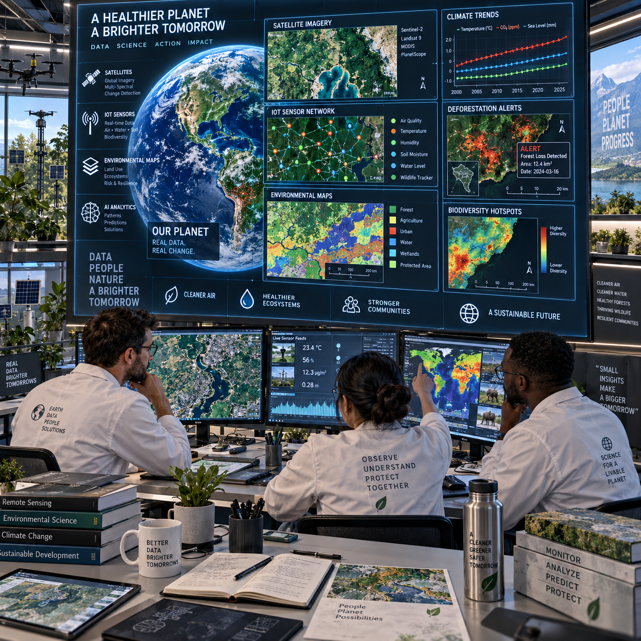
Environmental monitoring now produces information at a scale that traditional methods cannot always process efficiently. Satellites observe land and oceans repeatedly, Internet of Things (IoT) sensors record conditions continuously, and field teams generate detailed measurements across increasingly complex ecosystems.
Artificial intelligence (AI) and big data analytics help turn these observations into usable evidence. Their value lies in connecting data collection, analysis, prediction, and decision-making while keeping scientific judgment and field validation at the center.
Why Environmental Monitoring Needs AI and Big Data
Environmental monitoring needs AI and big data because modern datasets are too large, fast-moving, and diverse for manual analysis alone. These technologies help researchers identify patterns across time and geography, detect changes earlier, and direct human attention toward the most important findings.
Environmental data comes from many sources: weather stations, river gauges, air-quality instruments, satellite images, drones, biodiversity surveys, laboratory tests, and public reports. Each source has a different format, resolution, sampling frequency, and level of uncertainty. A satellite may cover an entire region but provide indirect measurements, while a field sensor may offer precise local readings but only from one location.
Conventional monitoring remains essential, particularly for calibration and verification. However, it can be expensive, geographically limited, and slow to scale. AI can examine thousands of images or sensor readings rapidly, while big data systems can store and combine information that would otherwise remain in separate databases.
The central challenge is therefore organizational as much as computational: environmental professionals must connect observations without losing context. A prediction about water quality, for example, becomes more useful when it incorporates rainfall, land use, upstream activity, soil conditions, and historical measurements.
How AI and Big Data Work Together
Big data provides the volume and variety of environmental information, while AI converts that information into classifications, forecasts, alerts, and decision support. The process usually moves through data collection, preparation, analysis, validation, and communication.
Remote sensing satellites and aircraft collect multispectral and thermal imagery. IoT sensors measure temperature, humidity, particulate matter, soil moisture, noise, salinity, or water chemistry. Geographic information systems (GIS) add location and spatial relationships, allowing analysts to compare observations with roads, watersheds, protected areas, industrial sites, and settlements.
Before analysis, datasets require cleaning and harmonization. Missing readings, duplicated records, sensor drift, cloud-obscured imagery, inconsistent coordinate systems, and different measurement intervals can all distort results. Data engineers and scientists may standardize units, flag anomalies, and document uncertainty before applying a model.
Machine learning then identifies relationships within the prepared data. Classification models can distinguish forest types or detect floating waste in imagery. Regression models can estimate pollution concentrations. Time-series models can forecast drought conditions or temperature trends. Deep learning is especially useful for image and acoustic analysis, although it often requires substantial training data and careful validation.
AI output should be treated as evidence with a confidence level, not as an unquestionable fact. A useful workflow combines automated analysis with expert review, field observations, and transparent documentation.
NASA Earth science resources illustrate how satellite observations support research on atmosphere, land, oceans, and climate systems.
Key Applications Across Environmental Monitoring
AI and big data support environmental monitoring by detecting pollution, tracking climate change, mapping habitats, observing species, and improving ecosystem management. Their strongest applications combine repeated observations with spatial analysis and independent verification.
Air and water quality
AI can combine ground-based air monitors, meteorological data, traffic information, industrial records, and satellite observations to estimate pollution patterns between monitoring stations. Similar methods help assess nutrient loads, harmful algal blooms, sediment movement, and contamination risks in rivers, lakes, and coastal waters.
Models can identify unusual readings and help agencies prioritize inspections. They cannot, however, replace laboratory confirmation when regulatory decisions depend on precise chemical measurements.
Climate change monitoring
Climate change monitoring uses long-term datasets to track temperature, sea-level change, glacier retreat, vegetation stress, wildfire conditions, precipitation shifts, and extreme events. AI can detect trends in remote sensing records and improve forecasts by combining climate observations with land-surface and atmospheric data.
Long-term consistency matters here. A model may identify a pattern accurately while still reflecting changes in instruments, sampling methods, or data coverage. Researchers must distinguish a genuine environmental signal from a change in measurement practice.
Biodiversity and ecosystem health
Automated image recognition can help identify animals, plants, and land-cover classes in photographs or camera-trap images. Acoustic models can process recordings to detect birds, bats, insects, or human disturbance. GIS and remote sensing add information about habitat fragmentation, vegetation condition, and connectivity.
These tools expand the reach of biodiversity surveys, but rare species and underrepresented habitats can remain difficult to detect. Field ecologists are needed to interpret behavior, confirm species identity, and explain ecological relationships.
Disaster detection and ecosystem management
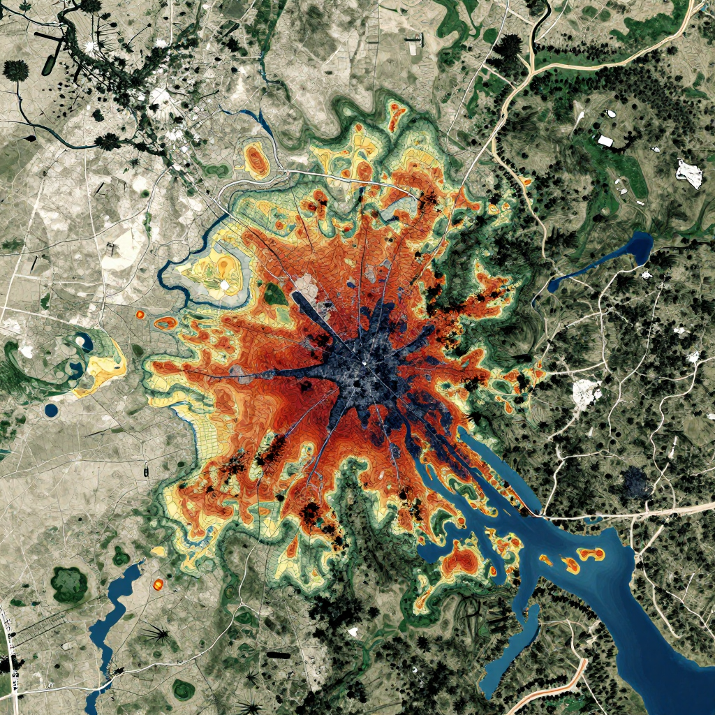
AI-supported systems can identify wildfire hotspots, flood extent, landslides, oil spills, storm damage, and illegal land clearing from near-real-time imagery and sensor data. Environmental managers can use these insights to prioritize response teams, protect vulnerable areas, and assess recovery.
Benefits for Researchers, Policymakers, and Communities
AI and big data improve environmental decision-making by making monitoring more timely, comprehensive, and accessible. They help different groups move from isolated measurements toward shared evidence and coordinated action.
- Earlier warnings: Continuous sensors and automated anomaly detection can flag changing air quality, rising river levels, or fire conditions before a conventional reporting cycle is complete.
- Better resource allocation: Agencies can target field visits, restoration funds, and emergency resources where risk indicators are strongest.
- Broader spatial coverage: Remote sensing fills some gaps between monitoring stations, especially in remote or difficult-to-access environments.
- More transparent analysis: Reproducible workflows, documented data sources, and visible uncertainty can strengthen public trust.
- Stronger collaboration: Shared platforms allow ecologists, climatologists, data scientists, planners, and communities to compare observations and methods.
For communities, accessible environmental dashboards can make technical information easier to understand and support participation in local decisions. Yet transparency requires more than publishing a colorful map. Users need information about update frequency, measurement limits, model confidence, and who is responsible for acting on an alert.
The practical benefit is greatest when an AI result connects to a defined decision. A forecast has limited value if no agency has a response protocol, budget, or authority to use it.
Challenges and Responsible Implementation
Responsible environmental AI requires reliable data, interoperable systems, fair access, transparent models, strong cybersecurity, and meaningful human oversight. Technical performance alone cannot establish that a monitoring system is trustworthy.
Data quality and interoperability
Biased sampling, missing records, sensor failures, and inconsistent standards can produce misleading outputs. A model trained mainly on well-monitored urban areas may perform poorly in rural or low-income regions. Interoperability standards, metadata, calibration routines, and clear data provenance reduce these risks.
Bias, privacy, and governance
Environmental data can reveal information about households, farms, Indigenous territories, or private land. High-resolution imagery and location data require careful privacy protections and consultation with affected communities. Environmental data governance should define who can access data, how it may be reused, how sensitive information is protected, and how communities participate in decisions.
Interpretability and human judgment
Complex models may produce accurate classifications without showing why they reached a conclusion. Explainable AI methods can help, but explanations still need scientific review. A transparent, slightly less complex model may be preferable when regulators or communities must understand the basis for an action.
Cost, energy, and unequal access
Data storage, connectivity, specialist staff, and model maintenance create continuing costs. Large computational systems also consume energy. Choosing a highly sophisticated model for marginal accuracy gains may be difficult to justify where a simpler method can meet the monitoring objective. Edge computing can reduce data transmission, but local devices may have limited processing capacity.
Common implementation mistakes include treating poor-quality data as a software problem, deploying a model without local validation, and measuring success only by prediction accuracy. A better approach evaluates false alarms, missed events, maintenance requirements, accessibility, and actual environmental outcomes.
The Role of Environmental Conferences and Collaboration
Environmental conferences help turn promising AI and big data methods into tested, shared, and responsibly governed practice. They bring together researchers, policymakers, technology specialists, field practitioners, community representatives, and environmental organizations that rarely work from the same institutional perspective.
Conference presentations can compare how different teams define data quality, validate models, report uncertainty, and measure real-world impact. Workshops may connect satellite analysts with conservation managers or pair machine-learning researchers with specialists in water chemistry and public health.
These meetings also expose limitations that may remain hidden in a technical paper. A model that performs well in one watershed may require new training data elsewhere. A dashboard designed for scientists may be unusable for emergency staff. Direct discussion helps identify such gaps early.
Important collaboration outcomes include shared metadata standards, open benchmarking datasets, ethical guidance, cross-border monitoring projects, and partnerships between universities, public agencies, technology teams, and local communities. For conference participants, the most valuable question is often practical: What evidence would another team need to reproduce, challenge, or responsibly apply this result?
Future Directions in AI-Powered Environmental Monitoring
The future of AI-powered environmental monitoring will focus on real-time integration, explainable analysis, edge computing, community-generated data, and stronger governance. Progress will depend on connecting technology with durable scientific and institutional practices.
Integrated data platforms will increasingly combine satellite imagery, IoT sensors, GIS layers, weather models, field surveys, and historical archives. Real-time systems may support faster responses to floods, fires, pollution events, and disease risks, provided that alerts are validated and linked to clear procedures.
Explainable AI will remain important for environmental regulation and public accountability. Researchers are also likely to expand edge computing, where data is processed near the sensor. This can reduce transmission requirements and support monitoring in remote areas with limited connectivity.
Community-generated data offers another important direction. Local observations can reveal environmental changes that formal networks miss, especially when communities have long-term knowledge of seasonal conditions and ecosystem behavior. Such data needs respectful governance, quality checks, and fair recognition of contributors.
The strongest future systems will follow a simple principle: automate repetitive analysis, preserve human responsibility, and make uncertainty visible. AI and big data can greatly extend environmental monitoring, but their success will be measured by better knowledge, fairer decisions, and healthier ecosystems rather than by technical complexity alone.
Frequently Asked Questions
What is the role of AI in environmental monitoring?
AI analyzes environmental data to identify patterns, classify observations, detect anomalies, and support forecasts. It helps specialists process large datasets while fieldwork and scientific judgment remain essential.
How does big data improve environmental decision-making?
Big data combines information from satellites, sensors, GIS, surveys, and databases. This broader evidence base can improve trend analysis, early warnings, resource allocation, and policy evaluation.
What environmental challenges can AI help monitor?
AI can support monitoring of air and water pollution, climate change, biodiversity, habitat loss, wildfires, floods, ecosystem health, and other environmental risks.
What are the main risks of using AI for environmental data?
Key risks include poor data quality, biased sampling, privacy breaches, opaque models, cybersecurity threats, high costs, energy use, and unequal access to technology.
Why are collaboration and conferences important in this field?
Collaboration and environmental conferences allow experts to compare methods, test assumptions, develop standards, share data practices, and build partnerships that connect research with practical environmental action.